
Description
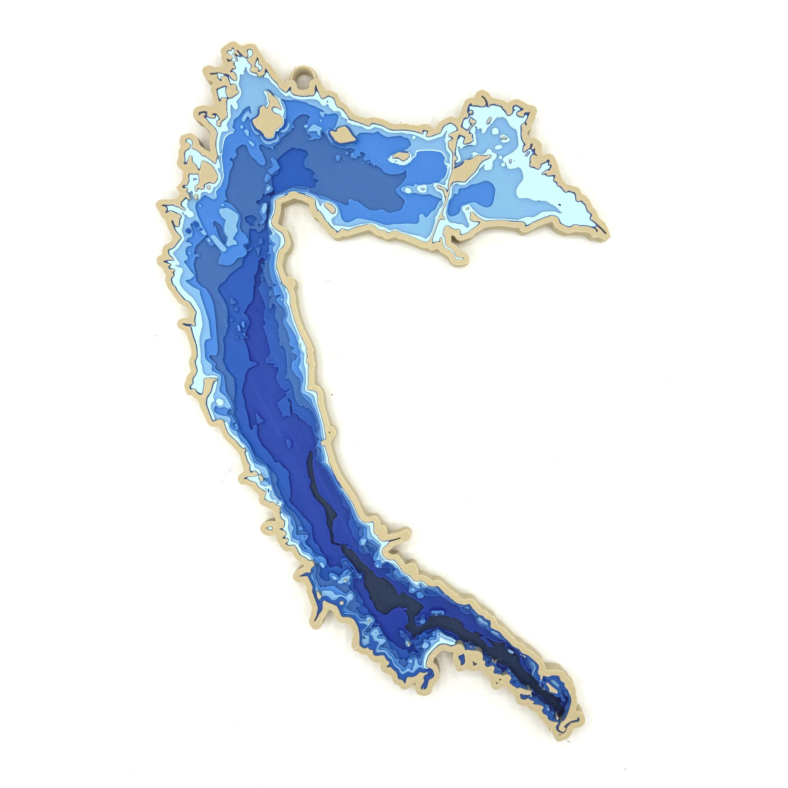
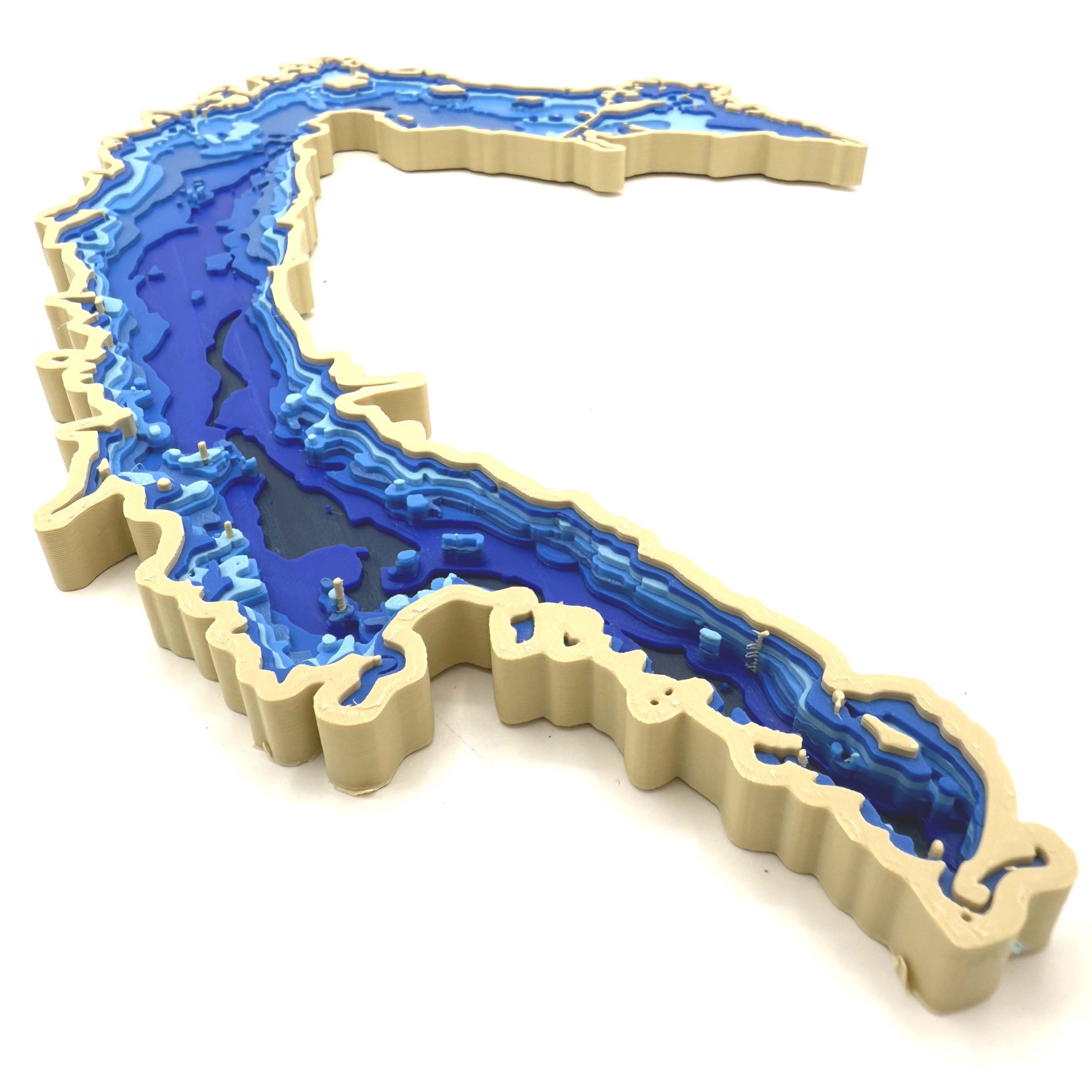
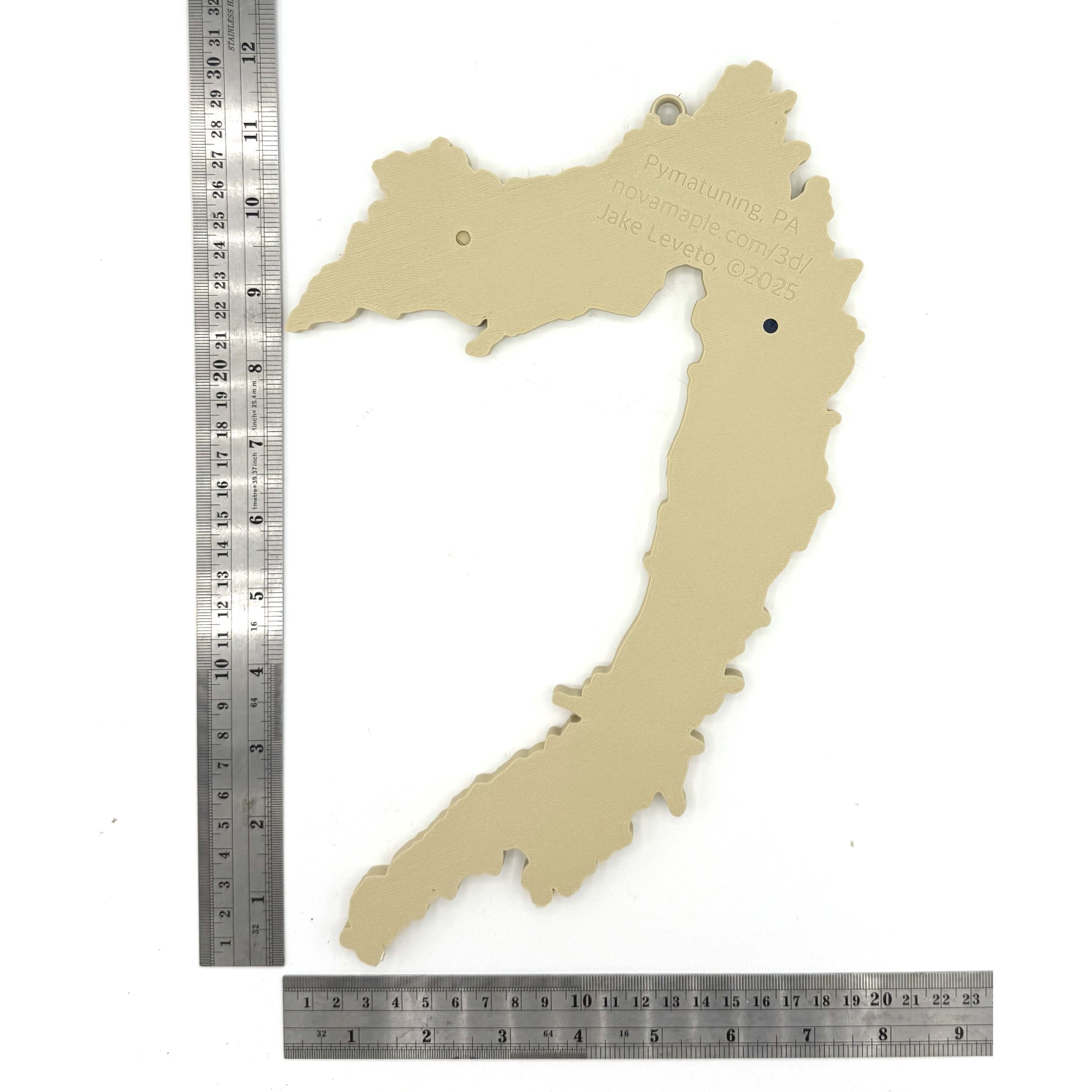
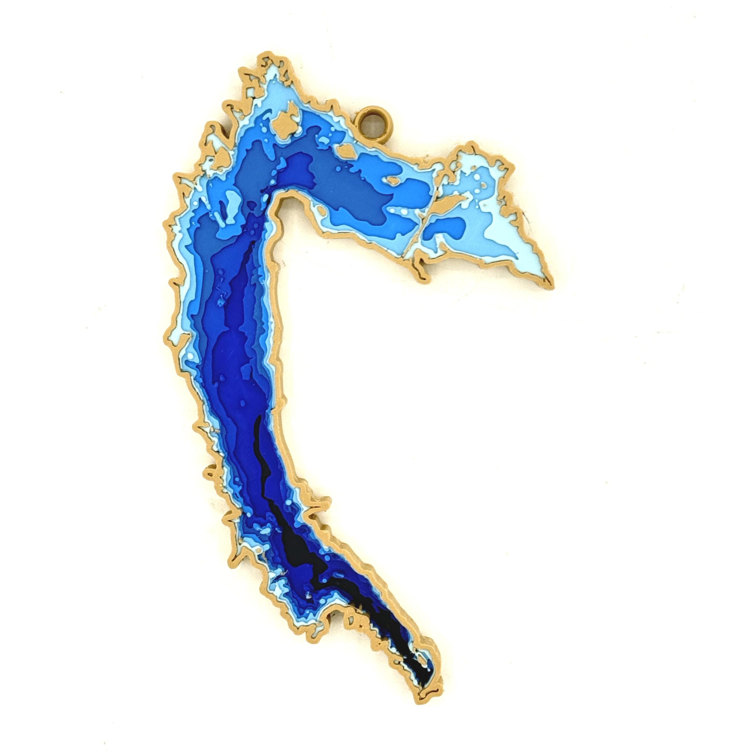
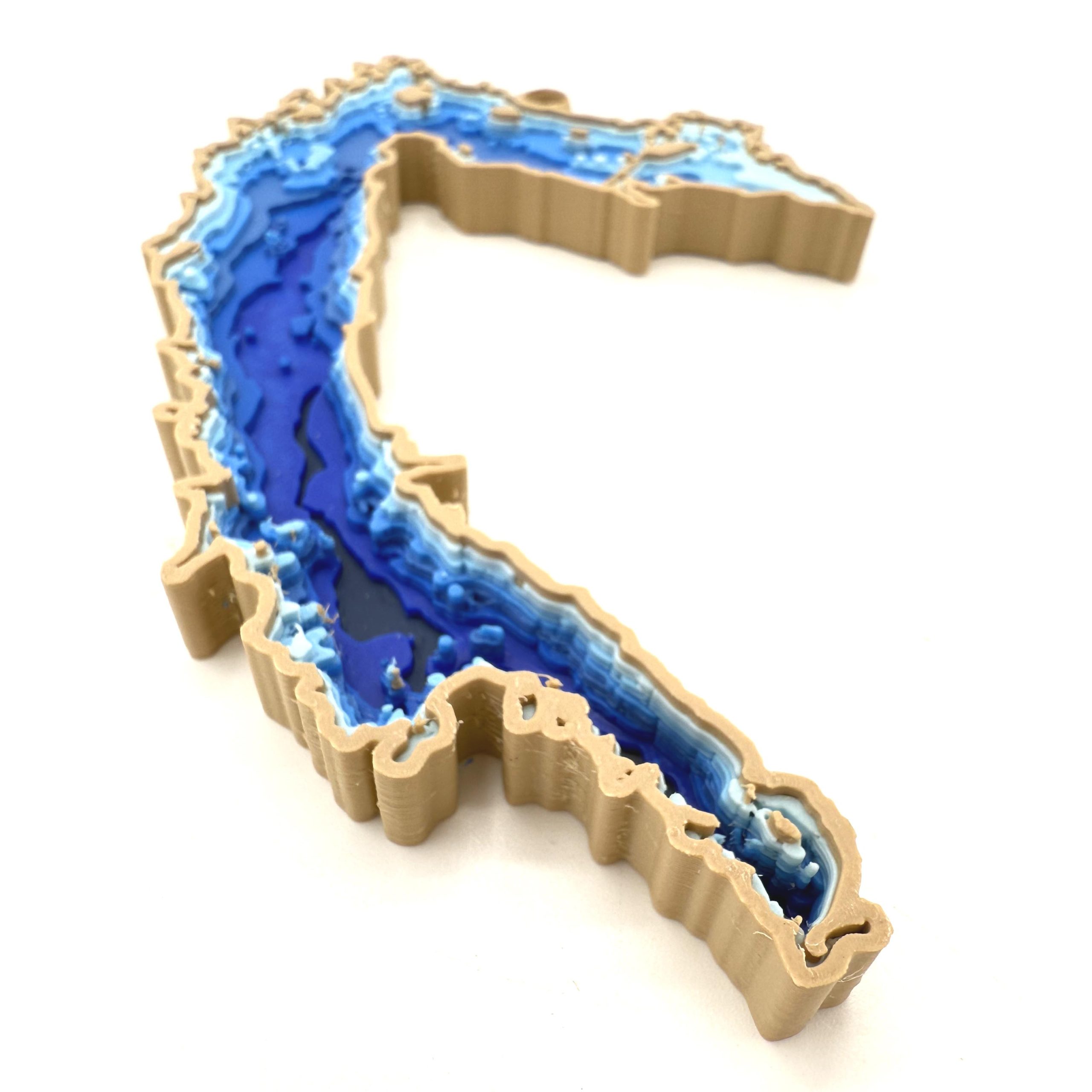
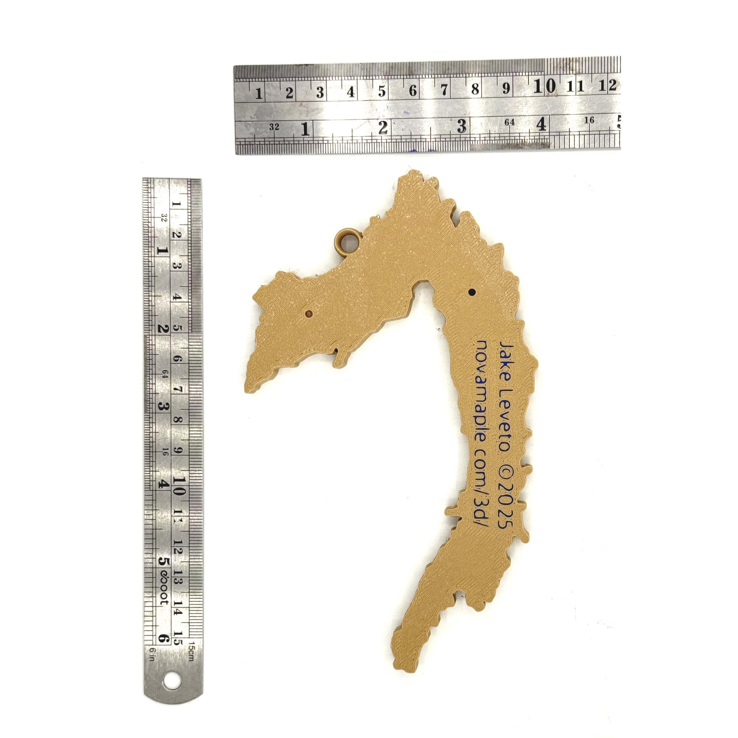
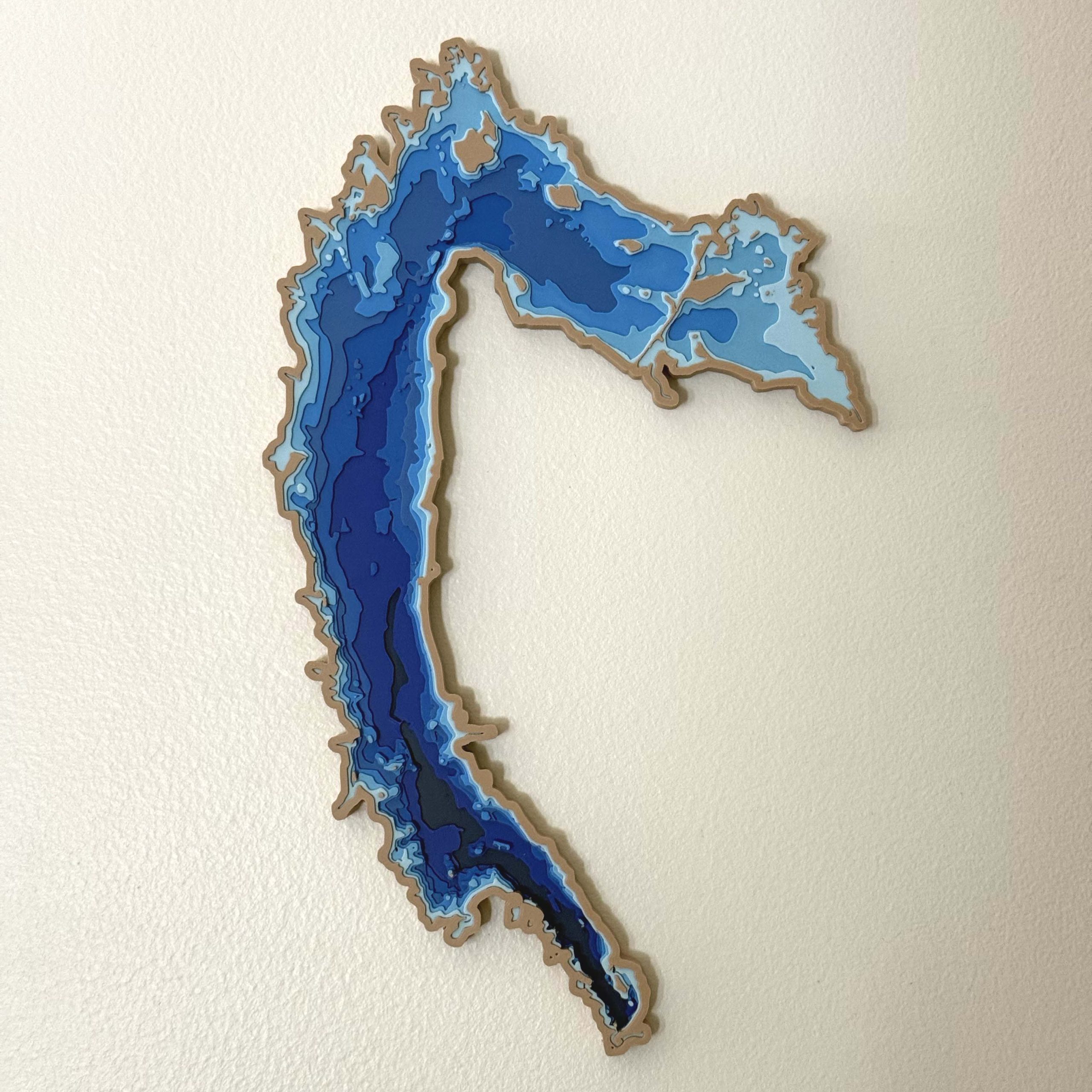
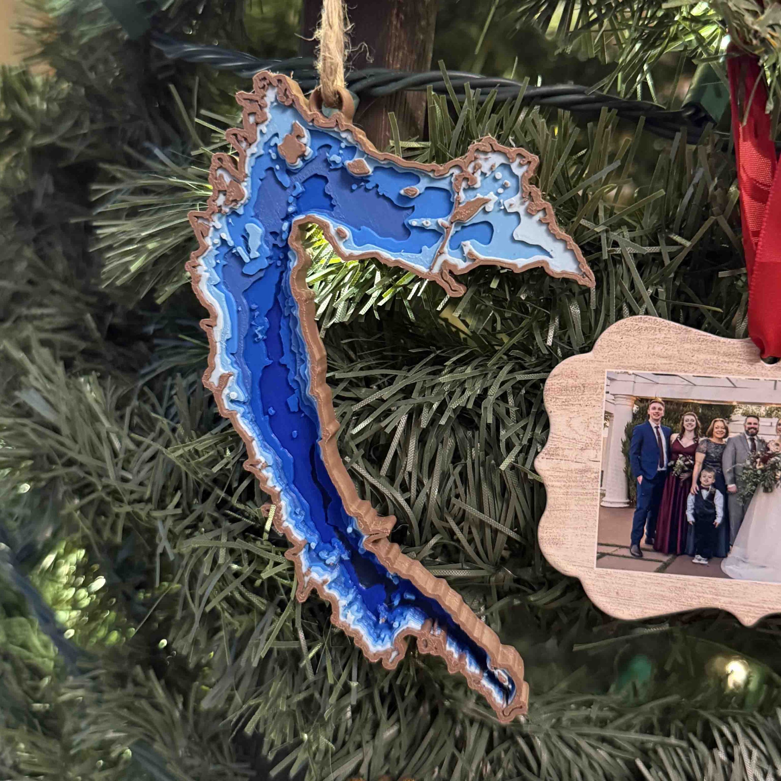
This striking 3D-printed depth map brings Pymatuning Lake to life with a vivid display of layered topography and aquatic depth. Spanning the Pennsylvania-Ohio border, Pymatuning’s iconic shape is outlined in soft tan, while its depths are rendered in a gradient of deep to light blues—highlighting the vast shallows and deeper channels of this beloved reservoir. Intricate cutouts represent islands, inlets, and shore features with remarkable accuracy, offering both a visual and tactile experience. Ideal for lake enthusiasts, anglers, or local residents, this piece beautifully blends artistic craftsmanship with geographic precision.


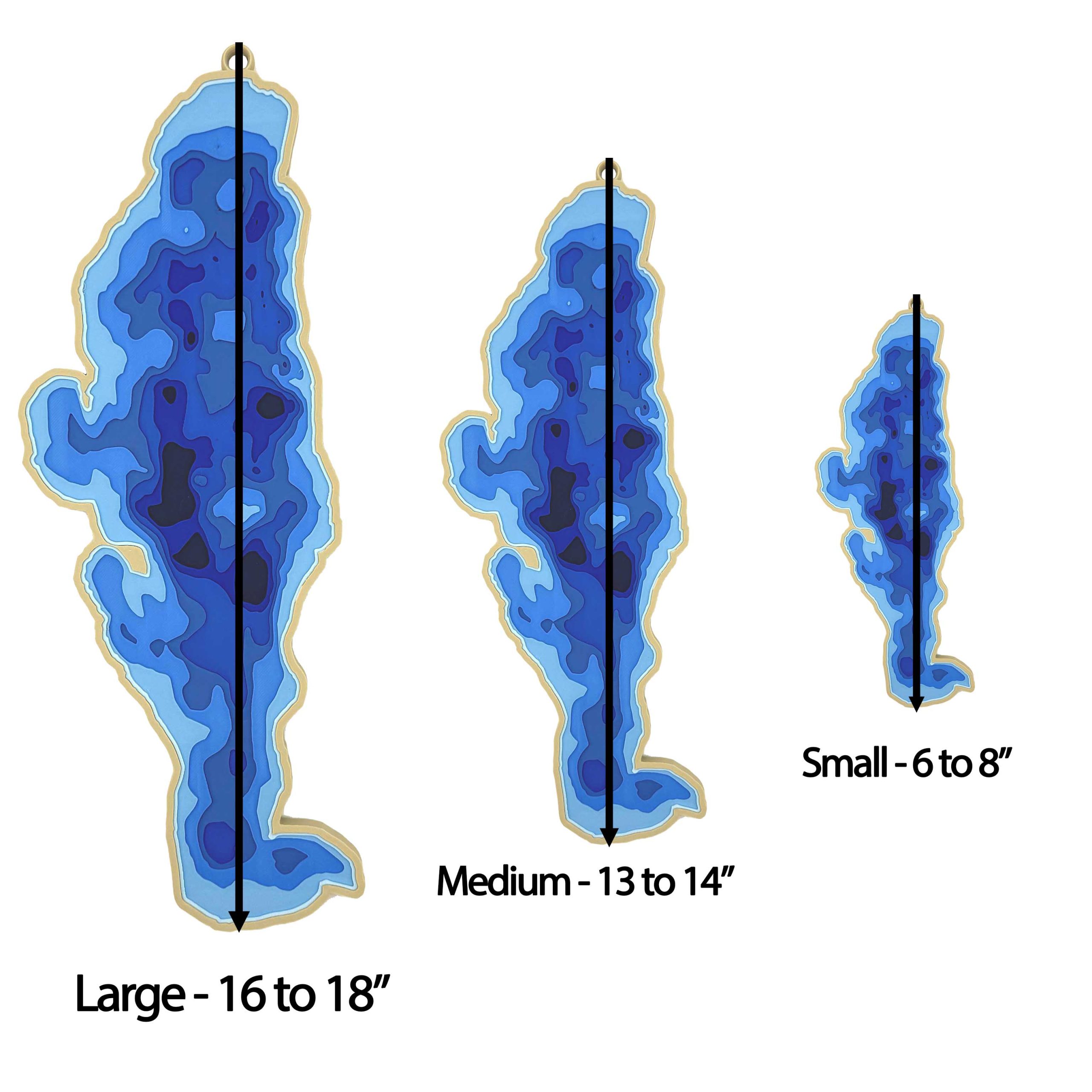
Hello, I’m local to the area (Conneaut Lake) and was wondering if I could purchase one of the large Pymatuning 3D models and pick it up rather than pay for shipping. If that’s a possibility that would be great! Thank you for your time!
-Wil
Hi Wil, you definitely can. I just emailed with details. Thanks!